Export facilities enable model data to be converted into formats useful
to teams working with :
US Environmental Protection Agency's EPANET software.
- Interchange is based on EPANET's INP file.
Computer aided drafting (CAD) tools.
- Interchange is based on AutoDesk's DXF file standard for CAD drawing data exchange.
Geographic information system (GIS) tools.
- interchange is based on ESRI's SHAPE file standard for GIS data exchange.
This standard works with a suite of three files (.SHP, .SHX and .DBF) to manage information in the SHAPE format; or
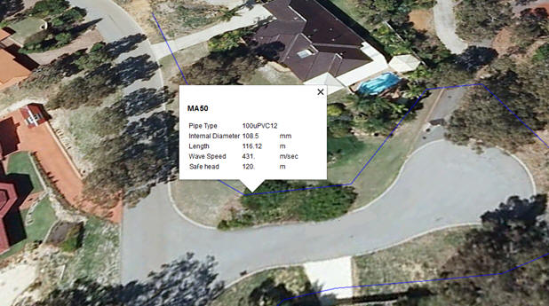
- Key Hole Markup language (KML) for display as a Google Earth overlay.